Survey And Geospatial
High-Density LiDAR Scanning
Fast, accurate, high-density, 3D data collection.
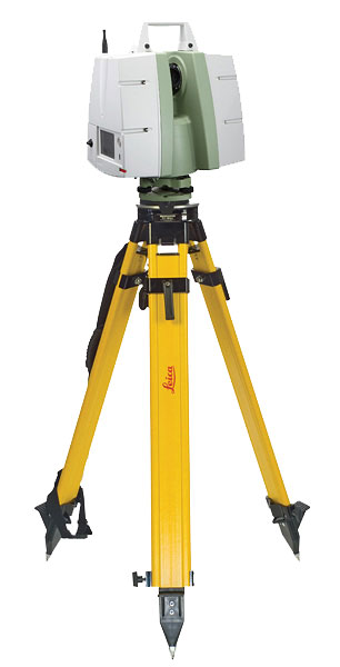 LiDAR scanning technology offers our clients immediate and tangible benefits on a wide range of projects. High-density scanning (HDS) collects a complete 3D model of a project site, with every laser point connected to survey-quality X, Y, Z coordinates, as well as high-resolution digital imagery for simple and comprehensive image-assisted documentation. This allows our technicians to respond to additional site survey needs on-the-fly, without requiring time consuming (and potentially costly) site mobilizations. Scanning also can help to maintain a safe project site through fast data collection. Its remote collection capability allows us to keep the public and our crew members out of harm’s way.
Using HDS systems, our crews quickly deploy to a project site to collect a dense, accurate 3D data set. With appropriate control, these scans are rectified and then the required topographic data is extracted to create the site survey, including existing field conditions and all utilities and surface features. The system simultaneously collects digital imagery of the project site to aid in feature identification. Under the direction of a Texas RPLS, the resulting data is seamlessly integrated into our existing CAD platforms.