Survey And Geospatial
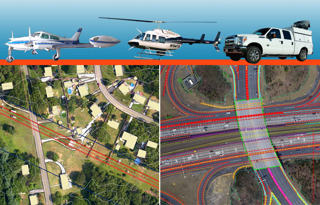
Aerial & Mobile Mapping
Coordinated project delivery for advanced mapping technologies.
VICKREY provides mobile LiDAR scanning, aerial LiDAR mapping and aerial orthophotography services for projects of any type in any location. VICKREY is able to provide the best technology for any geospatial requirement. VICKREY has strategic alliances with aerial and mobile data collection firms across the nation.
Acquisition assets we deploy include a dedicated Texas-based helicopter for LiDAR and imagery collection, a fleet of fixed-wing aircraft positioned throughout the nation and two mobile LiDAR mapping systems; all equipped with the latest in sensors, digital camera technology and expert pilots, operators and technicians.