Home

Contact Us

  • About
    • Awards
    • History
    • News
    • Teaming
    • Outreach
    • Contact Us
  • Markets
    • Federal
    • Land Development
      • Commercial, Office, Retail
      • Healthcare & Assisted Living
      • High Security Facilities
      • Industrial
      • K-12 & Higher Education
      • Mixed Use & Infill
      • Multi-Family
      • Parks, Recreation & Athletic Facilities
      • Religious Facilities
      • Residential
    • Municipal Services
    • Power Delivery
    • Public Works
      • Facilities
      • Flood Control
      • Parks & Linear Trails
      • Streets & Drainage
      • Utilities
    • Transportation
      • Aviation
      • Complete Streets
      • Highways & Roads
      • Rail
      • Regional Mobility
      • Transit
  • Services
    • Civil
      • Land Planning
      • Low Impact Development (LID)
      • Permits, Plats & Construction Documents
      • Site Design
      • Streets & Drainage
      • TRANSPORTATION & TRANSIT
      • Utilities
      • Water & Wastewater
    • Survey & Geospatial
      • Aerial & Mobile Mapping
      • Conventional & GPS
      • High-Density LiDAR Scanning
    • Program & Construction Management
  • Careers
    • Benefits
    • Current Positions
  • Home

Portfolio

TxDOT FM 20 Caldwell County

Submitted by sharkadmin on Thu, 12/23/2021 - 14:48
TxDOT FM 20 Caldwell County
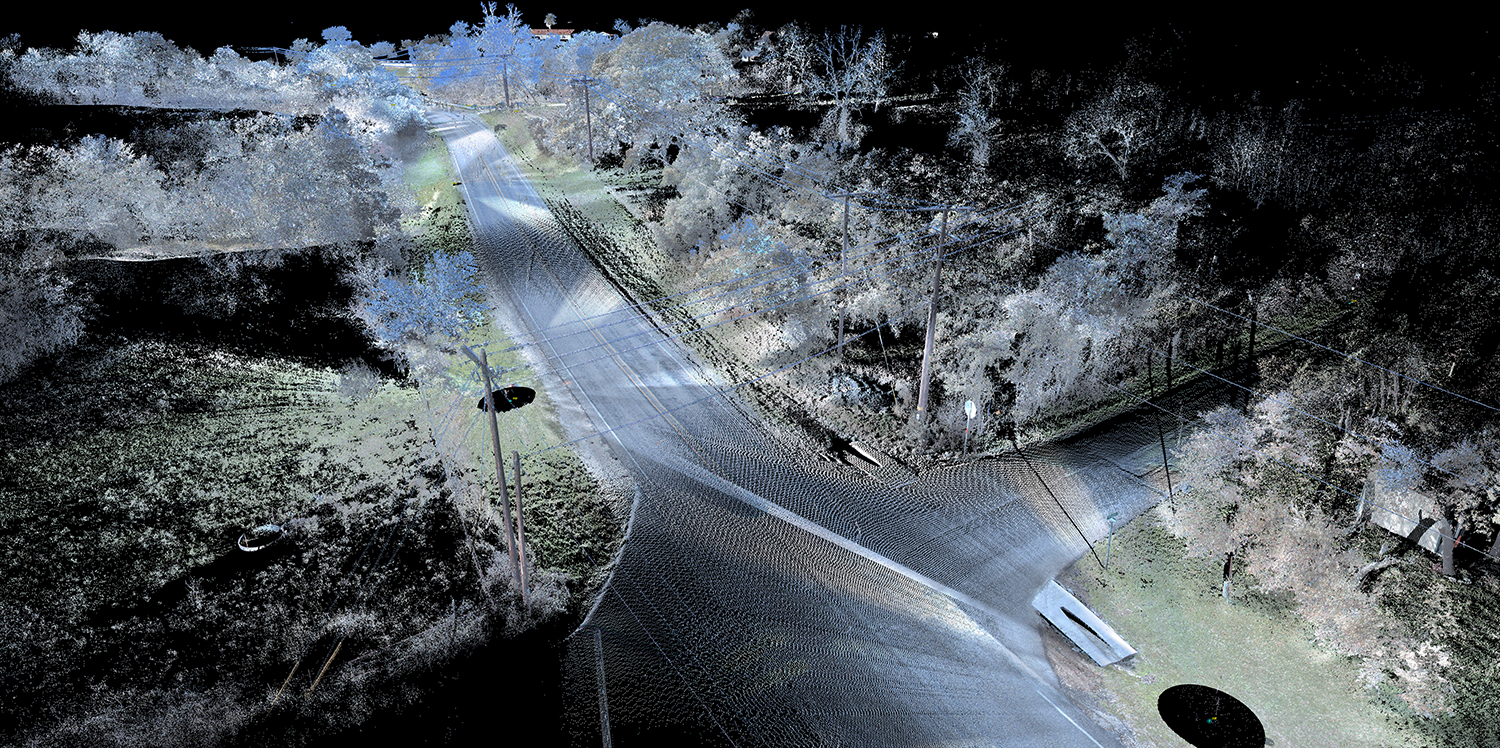
Services
Survey & Geospatial
Conventional & GPS
High-Density LiDAR Scanning
Aerial & Mobile Mapping
Markets
Transportation
Highways & Roads

© 2021 Vickrey & Associates, LLC. TBPE #F-159, TBPLS #10004100.
Contact Us | Sitemap | Terms & Conditions